Revolutionizing Construction with GPS Drone Progress Monitoring
- David Polan

- Dec 6, 2024
- 3 min read
Updated: Jan 26
The construction industry thrives on precision, efficiency, and effective communication among stakeholders. While traditional methods like timelapse cameras provide static insights, drone gps construction progress monitoring elevate site management to a new level. By integrating construction drone videography, these services provide periodic updates, dynamic perspectives, and unparalleled accessibility for stakeholders—especially in fast paced urban centers like Toronto.
Moving Beyond Static Timelapses
Traditional timelapse cameras have been a staple in construction monitoring for years. While they capture the progression of a site over time, they have significant limitations:
Restricted Perspective: These cameras are stationary, offering a fixed angle that misses crucial details happening elsewhere on site.
Limited Stakeholder Value: These visuals often require interpretation and fail to provide actionable insights.
GPS construction drone monitoring, on the other hand, offers a dynamic and versatile alternative.
Left: Security camera footage showing one angle only.
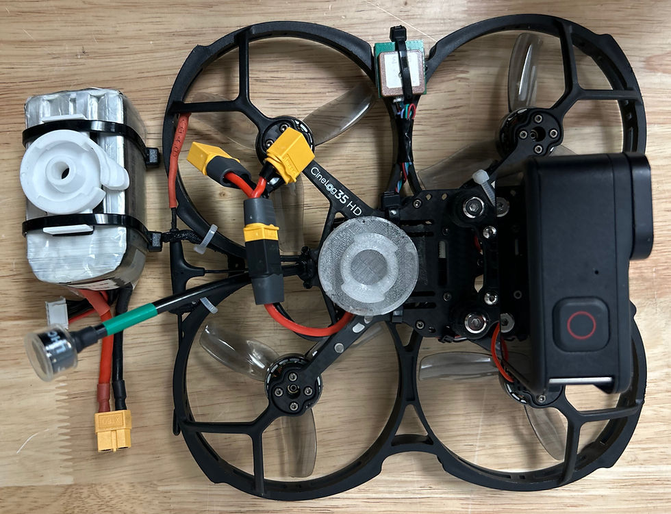
Right: Our drone ready for takeoff!
How GPS Construction Progress Monitoring Stands Out
Comprehensive Aerial Coverage: Our drones are equipped with high resolution cameras and can provide multiple angles of the entire construction site. Drones can move dynamically, capturing detailed footage through drone videography to highlight every stage of progress.
Real-Time Data: By utilizing drone construction monitoring, our drone services deliver accurate, real time visuals. This allows construction teams to track milestones and identify issues as they arise, reducing delays and inefficiencies.
Remote Stakeholder Access: One of the greatest advantages of drone construction monitoring is the ability to share updates with stakeholders. From contractors to architects and city planners, everyone involved can assess progress from the comfort of their office without the need for on site visits.
Benefits for Stakeholders
Enhanced Communication: GPS drone monitoring and drone videography bridge the gap between on site teams and remote stakeholders by providing a shared, visual understanding of progress.
Cost and Time Savings: By reducing the need for frequent site visits, drone services save significant time and money while delivering better data than traditional methods.
Increased Transparency: Drone images offer clear, actionable insights that enhance accountability among all parties.
How We Do It?
Working with the City of Toronto
First Class Drones offers construction monitoring with drones in Toronto.
At First Class Drones, we design flight paths customized to align with the client’s vision. Below are two projects currently in progress, one in downtown Toronto on the left and the other in Scarborough on the right.
After planning the flight, we meet our client on site to review and finalize it. This process can take 2-4 hours to perfect, ensuring the flight meets the client’s expectations. Once finalized, we adhere to the scheduled visits and provide the client with the video or photos each time. When the project is fully completed, we edit a video to showcase all the site visits, transforming the footage into a stunning moving timelapse. See the video below for an example.
The Future of Construction Monitoring
The integration of GPS drone monitoring and drone videography is revolutionizing how construction projects are managed. This tool not only enhance operational efficiency but also allow for collaboration and trust among stakeholders. For developers, contractors, and city officials, embracing drone technology like drone construction progress monitoring ensures projects stay on schedule, on budget, and compliant with safety standards.
Curious about how our drone services can elevate your construction project? Visit First Class Drones to learn more and see how we can transform your project management.

Blog written by:
David Polan
Director Of Business Development at First Class Drones
Bio:
David has been with First Class Drones for over six years, combining his passion for technology with a creative approach to aerial storytelling and business development. He has extensive experience piloting both traditional and FPV drones, bringing dynamic perspectives and cinematic precision to every project.
Today, David serves as Head of Business Development and Senior Pilot at First Class Drones. He is excited about the future of drone technology and looks forward to the innovative projects on the horizon for First Class Drones.


Comments